
England Stone circles
The following article is a chapter from my book (published in Hebrew) – England in search of the Holy Grail.
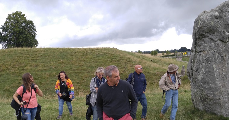
Avebury
John Aubrey discovered the stone circle in Avebury in 1648, and it is named after him. Seventy years later, Dr. William Stukeley, a Freemason and scholar of ancient esoteric traditions, visited the site. Stukeley discerned Avebury’s symbolism and viewed it as a monument to an ancient faith, a universal religion that, in unknown prehistoric times, dominated the world. This ancient faith gave rise to the traditions of the Pythagoreans, the Gnostics, the alchemists, the Kabbalah, and more. The discovery of Avebury, along with Stonehenge, reinforced the British sense of antiquity and prestige, providing them with landmarks comparable to the pyramids.
The Avebury site is a complex area, requiring at least half a day to explore fully, with a whole day recommended to appreciate it and its surroundings. The site comprises at least five different locations: the Stone Circle (where it is recommended to visit the Avebury Museum within the circle), Windmill Hill, Silbury Hill, the West Kennet Long Barrow, and the Eastern Avenue. Additionally, not far from Avebury is a dolmen called Devil’s Den. Nearby are the beautiful Kennet and Avon Canal and the town of Marlborough. This area is central to the phenomenon of crop circles, mysterious formations with complex geometric shapes that appear in wheat fields every summer, claimed by some to be created by UFOs.
Avebury’s geographical location is central to Great Britain in several respects. Firstly, it is situated exactly in the middle of England’s main energy line, the St. Michael line, which connects St. Michael’s Island, Glastonbury, and the Dorset coast. Secondly, Avebury is located on the old road between Bath and London, halfway between the East and West of England, and near the Kennet and Avon Canal, which connects Bristol with London and the Avon, Kennet, and Thames rivers. The canal, dug at the beginning of the 18th century, is now a popular tourist site. In fact, the Avebury area is the source of the River Kennet, a major tributary of the Thames. Additionally, Avebury’s location is significant in relation to other historical sites such as Salisbury. Considering the entire British Isles as one living organism, Avebury plays a central role within it.
The Avebury site is the largest megalithic complex in Britain and one of the oldest. It exemplifies a complex that has developed over the years, containing all the elements of the megalithic religion: a circle of stones, a rampart, procession routes, a long burial mound, an artificial hill, and more.
Avebury’s enormous stone circle is surrounded by a ditch and a circular earthen embankment. The diameter of the embankment is 347 meters, similar to the nearby Windmill Hill complex, which has a diameter of 364 meters. The perimeter of the embankment is more than 1,000 meters, and it was likely established as early as 3000 BC. It has four openings aligned with the cardinal directions. Inside the embankment is a stone circle with a diameter of 331 meters. The stones were placed after the embankment and enclosure were completed, possibly replacing earlier wooden poles. There were originally 98 stones in the circle, each averaging 4 meters in height and 40 tons in weight.
Inside the large circle are two sub-circles. The northern sub-circle has a diameter of 98 meters, with only a few stones remaining. In the middle was a smaller circle of stones, and within that, a cluster of three huge stones called “Cove” in English, a term without an exact translation in Hebrew, somewhat akin to a niche. The southern sub-circle has a diameter of 108 meters. Inside it was a smaller circle of stones, with a tall menhir (like an obelisk) at the center, standing 5.5 meters high. The two circles likely symbolized the sun and the moon, and within them, dances took place and music was played, resonating with the help of the stones.
Avebury’s circle is situated in a natural depression, a valley, which enhances the sense of inclusion and separateness of the circle. In ancient times, it is likely that a forest surrounded the high earthen embankments, while the sacred area inside remained open, reinforcing the feeling of it being a “sacred area.” The location of the site was carefully chosen, with legends claiming that no snakes inhabit the sacred area, and if a snake is brought there, it will die.
From the great circle, long procession ways bordered by rows of stones extend on both sides. The eastern avenue remains largely intact, with pairs of tall stones lining the path. This is considered the most energetic part of the site. Those who walk the eastern avenue will encounter Silbury Hill and the long burial mound of West Kennet along the way. According to archaeologists, this alignment is intentional. [1]
William Stukeley suggested that the overall layout of Avebury resembles the ancient symbol of a serpent and a winged disk (or dragon), symbolizing the union of opposites. The serpent (and the eastern avenue) ends in a stone circle about two and a half kilometers from Avebury, at a sacred complex called The Sanctuary on a high ground, offering views of all the surrounding sites. In the past, The Sanctuary featured a stone circle with a diameter of 40 meters, consisting of 42 stones, and a circle of wooden poles. The stones were destroyed during the 18th century, with only Stukeley’s drawings and archaeological excavations providing evidence of their existence. The area surrounding the circle contains many burial mounds, such as those of West Kennet, East Kennet, and others.
Avebury is largely identified with Alexander Keiller, who lived and worked there in the 1930s. An amateur archaeologist and mystic, Keiller was also a man of means. He purchased a large portion of the site, conducted independent excavations, and restored the area by re-erecting stones and marking the places of missing ones. The artifacts he uncovered were organized in the museum named after him, located at the site. Ultimately, he donated the museum, all the lands he owned, and his private estate to the English National Trust.
To the south of Avebury is a huge artificial hill called Silbury Hill, and further south lies the long ridge of West Kennet. To the north of Avebury is the Windmill Hill complex. Alexander Thom suggested that the Avebury complex as a whole reflects the star system of Cygnus (the Swan) and that a megalithic yard was used in the construction of the site.
Silbury Hill
Silbury Hill is part of the Avebury complex and is the largest artificial mound in Europe, comparable in scale to the pyramids, and was constructed about 5,000 years ago. At the heart of the hill is a smaller, older mound made up of layers of chalk, flint, gravel, grass, and clay. [2] Surrounding this core were rows of hewn limestone blocks with gravel in between. Today, the hill appears as a natural earthern mound, but in the past, it resembled a round white pyramid with seven steps glistening in the sun. Shortly after its construction, the hill was covered with earth, giving it its current shape. The hill’s diameter today is 167 meters, its height is 40 meters, and the top has a surface with a diameter of 30 meters.
It is fascinating to note that Silbury Hill was built around the same time as Djoser’s Step Pyramid in Egypt. Both structures were made of white limestone and featured steps—seven for Silbury Hill and seven for Djoser’s pyramid. Silbury Hill’s height is two-thirds that of Djoser’s pyramid. Additionally, Silbury Hill resembles the ziggurats (pyramidal temple buildings) of ancient Babylon, which were constructed around the same time. Two of the most famous ziggurats, the White Temple in Uruk and the ziggurat in the city of Ur, are comparable in height to Silbury Hill and also featured white temples on top that shone in the sun.
Silbury Hill is located about 1.5 kilometers from the stone circle of Avebury, near the end of the eastern avenue, 400 meters from the springs that form the source of the River Kennet, and a little farther from the long barrow of West Kennet.
West Kennet Long Barrow
One of the remarkable features of the Avebury complex is a long barrow (an artificial earthern mound with cavities) that is 100 meters long and 20 meters wide. At its core, there is a long, narrow passage built of huge stones, ending in five rooms arranged in a double cross formation, creating an exact isosceles triangle whose height is twice its width. The corridor begins with a semicircular area enclosed by several massive stones, which may have had engravings in the past.
The long barrow is the oldest structure in Avebury and one of the oldest in Britain. It was constructed in two phases—the first around 3600 BC and the second several hundred years later. Inside, archaeologists found 46 skeletons of people of various ages from the time of the barrow’s establishment. Most of the skeletons had their skulls and some large bones separated from the bodies, likely for ritual purposes. Who were these people? Was the long Burrow built in their honor?
Some believe that the long barrow was built to symbolize the transition from a society based on gathering and hunting to one based on agriculture, representing a sort of womb of Mother Earth, which gives birth to both wheat and humans after death.
The barrow is aligned along the east-west axis, the axis of the sunrise, which likely held significance for the ancients. They may have managed to direct light rays inside, symbolizing the fertilization of the earth and a new birth, a theme that also appears in the nearby stone circle of Avebury, located about two kilometers to the northwest.
Near the West Kennet Long Barrow (about a mile and a half southeast) is a similar monument, the East Kennet Long Barrow. Silbury Hill is about 400 meters north of it. About a thousand years after the establishment of the long barrow, the Beaker culture emerged in Britain. For some reason, the people of this culture filled the barrow’s corridors with dirt mixed with pottery and bones. Worship at the site ceased, and they likely began using the stone circles instead.
Windmill complex
This hill, located about 2 kilometers northwest of the stone circle at Avebury, is one of the older parts of the sacred complex. About a thousand years before the famous stone circle was established, a bank with a diameter of 364 meters (similar to the size of the outer bank in Avebury) and a surrounding ditch were constructed. Human bones and ceramics were buried in this ditch. The hill served as a sacred meeting place for an ancient prehistoric culture, later named the Windmill Hill culture. The outer bank and ditch were first created around 3800 BC, and in 3300 BC, two more inner ditches and several circular burial mounds were added inside the circle.
Marden Henge complex and West Wood Hills
Avebury and Stonehenge are aligned along a north-south axis, with the Marden complex, also known as Hatfield Earthworks, situated near the village of Marden in between them. The Marden complex is ten times larger than Stonehenge and even larger than Avebury, although today it is not easily distinguishable. In the past, a 3-meter-high embankment surrounded the sacred compound, which covered 40 hectares and had an asymmetrical diameter of 500 meters, partly bordering the River Avon. At the center of this complex was a mysterious stone building where a fire was kept burning. This structure may have served as a kind of “sweat lodge” for shamanic rituals or a place where attempts were made to produce metals by magical means.
The embankment was very wide and had two openings, one in the north and one in the east. Inside, there was a large artificial hill with a diameter of 70 meters and a height of 20 meters. To the south of the river was another circular sacred compound, surrounded by a 100-meter-diameter embankment, where remains of standing stones and wooden poles (a kind of obelisk) were found.
North of Marden and near Avebury (a few kilometers to the southeast) is an area of hills near the village of Lockeridge called West Woods. In this wooded and relatively small area, there is a unique cluster of natural sarsen stones (a type of hardened sandstone), large and shaped like natural blocks, mostly or partially detached from the ground. Sarsen stones always appear as detached blocks from the ground and were therefore considered sacred. Scientists have proven that the stones used in the nearby Avebury and Stonehenge stone circles, which weigh tens of tons, are sarsen stones brought from the West Woods area, a distance of 23 kilometers from Stonehenge and 5 kilometers from Avebury.
The presence of large, detached stones grouped together and distinct from the surrounding chalk environment symbolized for the ancients the presence of deities, these stones were perceived as a type of frozen human beings or as containing entities, similar to other unusual stone clusters found elsewhere in England, such as Chesil Beach, or around the world, such as Beglik Tash in Bulgaria. From the sacred area of the West Woods, these stones (entities) were taken and arranged in sacred forms in agricultural centers like Avebury and Stonehenge, intended to bring blessings to the land. The common origin of the stones underscores the connection between Avebury and Stonehenge, which are located on a north-south axis, 28 kilometers apart. First, Avebury and the sacred complexes in East and West Kennet near West Woods were built, followed by the construction of the Marden complex south of West Woods and the Stonehenge complex to the south, and later the Sarum Hill complex further south along the same axis.
Scientists believe that the big stones of Stonehenge were transported from West Woods through the Marden complex. There is a theory suggesting that these stones were shaped at Marden, which served as a kind of sacred workshop.

Stonehenge
According to John Michell, Stonehenge was the main site of the Druids, serving as a precise mathematics and astronomy computer, and a place for rituals. It was carefully cultivated and guarded, in contrast to other stone circles and natural Sacred sites that were abandoned with the arrival of the Indo-Europeans in Britain in the second millennium BC and the transition from an ancient matriarchal culture to a patriarchal one. Generally, the Celts began to use sacred groves, wells, and springs instead of stone circles, quarries, and dolmens. However, Stonehenge was the exception, continuing to be active until at least 1000 BC.
According to archaeological research, the Stonehenge site was built in stages and, in addition to the large stones, included large-scale earthworks. The first stage, dating from 3200 to 2700 BC, involved digging a huge circular moat that enclosed a sacred compound. This compound originally contained standing wooden poles and was much larger than what exists today.
Between 2700 and 2200 BC, 56 pits were dug in a circle within the sacred area surrounded by the moat. The purpose of these pits remains unknown, though one hypothesis suggests they functioned as a an astronomical observatory for predicting lunar eclipses. Later, these pits were used to store the ashes of the dead.
It was only around 2200 BC that the first stones were brought to Stonehenge, about a thousand years after the site began to be used. These initial stones were bluestones, each weighing a few tons, transported from the Preseli Mountains in Wales, [3] approximately 320 km west of Stonehenge. They were arranged in two circles within the circular moat.
Between 2000 and 1600 BC, the larger stones in the outer circle were brought to the site. These stones, which stand out prominently in the landscape today, rise to a height of four meters, weigh tens of tons, and are buried about one and a half meters into the ground. They were transported from a distance of 23 km, from the West Woods area near Avebury. There are 30 large standing stones, each topped with 30 flat connecting stones, forming a perfect and impressive circle.
After the large outer circle was completed, even larger stones were added in the center, arranged in five groups of three. This inner semi-circle consists of trilithons, or gates. Surrounding these is a circle of bluestones, which were likely moved from the boundaries of the sacred area to the center. This marked the final stage of the site’s construction. Today, only half of the stones remain standing.
The Stonehenge site comprises several concentric circles. On the outside, there is a moat and the remains of an embankment (with a diameter of 110 meters), as well as 56 covered pits that hold astronomical significance. In the past, the embankment stood two meters high and had an opening toward the northeast, aligned with the sunrise on the longest day of the year. Later, two large sarsen stones were placed so that the sun would shine through the gap between them on the summer solstice.
Moving from the outside inward, there is a large and precise circle with a diameter of 33 meters, consisting of 30 connected sarsen stones topped by 30 horizontal stone slabs. Inside this circle is another circle of 60 relatively small bluestones. At the center of this arrangement is a series of five trilithons, forming an impressive and significant inner structure, [4] each built of two huge stones with a connecting flat stone on top. One of these trilithons is particularly tall, standing 7 meters above the ground with an additional 3 meters buried below. This configuration forms a U-shape open to the east, with two gates in the north, two gates in the south, and one gate in the west, reminiscent of the arrangement of rooms in the West Kennet Long Barrow.
Inside the semi-circle of trilithons is a horseshoe-shaped arrangement of 19 bluestones, also open to the east. At the heart of this compound lies a large, flat greenish sandstone slab, known as the Altar Stone. It measures 5 meters in length and, although it is now lying flat, it likely once stood upright at the center of the circle.
John Michell argues that the unit of measurement used at Stonehenge is the “megalithic rod” or sacred rod. This unit of measurement, which Isaac Newton also identified in his studies, is derived from the Earth’s polar radius (as the Earth is somewhat flattened). The sacred rod is equal to one six-millionth of the Earth’s radius, or 1.0594 meters. This measurement is reflected in the width of the large stones in the outer circle of Stonehenge. There are 30 stones, with the diameter of the inner circle they form being 28 sacred rods and the diameter of the outer circle being 30 sacred rods. In other words, the circle of the large stones is very precise and mirrors the dimensions of the Earth.
The sacred rod is similar in size, though not identical, to half of the megalithic yard discovered by Alexander Thom. This suggests that the construction principles of other ancient megalithic monuments differ from those of Stonehenge, indicating that Stonehenge likely belongs to a different and slightly later belief system. Stonehenge was built by a different culture or served a different function than other megaliths, which explains the precision in chiseling and placement of the stones, in contrast to the use of raw stones at nearby sites like Avebury.
According to Michell, the circumference of the perfect outer stone circle at Stonehenge is 316.8 feet, which is one hundredth of six miles. This measurement appears in John’s vision of the New Jerusalem in the New Testament and is related to the ideal of a holy city.
The circumference of the connected stone circle is equal in dimensions to the square that bounds the circle of small bluestones inside it. If a Star of David is placed inside this square, the circle formed inside the hexagram matches the dimensions of the semi-circle of small bluestones at the heart of the stone circle. Thus, the circles resonate and reflect each other through geometric and mathematical relationships, and they also reflect the dimensions of the Earth.
One of the notable features of the stone circle at Stonehenge is its alignment with the cardinal directions, Sun, Moon and and astronomical phenomena. According to Gerald Hawkins in his book Stonehenge Decoded, the circle functions as an elaborate astronomical observatory relating to the movements of the moon and the sun. Hawkins claims that the sun rises and sets at four extreme points associated with the longest and shortest days of the year. Meanwhile, over an 18.6-year cycle, the moon reaches eight key positions: twice at a northern maximum moonrise point, twice at a northern maximum moonset point, twice at a southern maximum moonrise point, and twice at a southern maximum moonset point. This creates eight moon-related directions and four sun-related directions.
When observing from within the circle through the pillar stones of the trilithons and further through the pillar stones of the outer circle, one can see prominent points on the horizon marked by artificial mounds. These points indicate the rising and setting positions of the sun and moon in the 12 special astronomical alignments.
Like Avebury, Stonehenge is situated in the heart of a natural depression and is precisely aligned with its surroundings. In fact, part of the environment was designed to match Stonehenge’s role as an accurate observatory. Hawkins expands on this topic, referencing the 56 hidden pits where wooden poles were previously placed.
Moreover, the embankment that surrounds the circle features an opening aligned with the sunrise on the longest day of the year. A large stone outside the circle, known as the Heel Stone or Sun Stone, casts a shadow into the circle during this sunrise. In the past, there was another large stone beside it, and a ray of sunlight passing through the gap between the two stones would enter the circle, symbolizing the connection (Sacred Marriage) of the male with the female.
According to most of the theories accepted today, the Stonehenge site was used as a sun and fertility temple, a place of worship were seasonal rituals took place, these rituals included music, using the blue stones as a type of xylophone, dance, and probably sacred marriage ceremonies (ritual sex).
John Michell proposed that Stonehenge is a temple of summoning energies, like other ancient temples. According to the first magical principle of “like attracts like,” every energy has a shape, color, number, sound, and arrangement, which forms the basis of sacred architecture. Stonehenge was designed to summon the energies of the moon and sun, representing the two great principles of nature—the male and the female. It was a universal temple, similar to the temples in Jerusalem and Karnak (Egypt), which, as long as they existed, enriched harmony and abundance in the world. Its destruction led to the country’s deterioration and the forgetting of old and good traditions. Michell believed that the temple is a diagram of the heavenly Jerusalem, akin to the Holy Grail’s enclosure at Glastonbury.
According to alternative sources, Stonehenge was a landing place for flying saucers, guided by magnetic lines, thus explaining its alignment with celestial bodies and the earth. In the nearby hills, there are huge drawings (tens of meters of exposed soil revealing the limestone rock underneath) of horses, and of prehistoric man called Cerne Abbas. These drawings are thought to be advertisements for the flying saucers; in other words, the saucers flew towards England, saw the figure of the prehistoric man on the hillside, and were directed to Stonehenge.
Some expand on the theory, [8] suggesting that after the initial successful trade came other saucers with traders who wanted to kidnap humans for slavery in other parts of the galaxy. The humans fought them off with bells. One of the greatest warriors was Arthur Pendragon. The ringing of the bell disrupted the magnetic fields, preventing the flying saucers from landing. This seemingly strange theory aligns with recent experiments conducted by Paul Devereux at Stonehenge, which showed that the bluestones have acoustic properties, suggesting that they served as a sort of giant xylophone played on special days of the year. Stonehenge has always been a place of music and dancing, and it still is today. Did the frequencies help the flying saucers land or drive them away? We’ll never know…
According to Geoffrey of Monmouth, who first wrote down the legends of King Arthur in the 12th century, the wizard Merlin built the stone circle of Stonehenge, and the stones, which have healing properties, were brought by giants from Africa.
Stonehenge was rediscovered in the 17th century and adopted by Druid revivalists led by William Stukeley. Since then, the site has become a place of ceremonies for the Neo-Druid and Neo-Pagan movements. However, at the time of Stonehenge’s initial construction (around 3200 BC), there were no Celts or Druids in Britain. The site was inhabited by people from the Beaker culture, about whom little is known. The Celts and Druids arrived much later. By around 1600 BC, a Druid priesthood was present in Britain, characterized by astronomical, geometric, and mathematical knowledge. It is possible that their knowledge already existed in earlier civilizations.
In conclusion, as with the pyramids in Egypt and other wonders of the ancient world, much about Stonehenge remains hidden beyond the visible. Who founded this remarkable site and for what purpose? How did they transport the bluestones from such great distances, and why? How did they move the massive sarsen stones? What were the measurement bases, and what is the sacred plan or architecture of the place?
It is important to recognize that Stonehenge is not an isolated complex but part of the broader megalithic system of southern England. Not far from the stone circle of Stonehenge lies the large and ancient sacred complex of Marden, surrounded by a rampart, along with numerous burial mounds in the area. Some archaeologists suggest that Stonehenge was a sacred site as far back as 10,000 years ago, used for burial or the interment of ashes, serving as a connection between heaven and earth. Others argue that Stonehenge was a healing center.
Today, visitors can explore a beautiful visitor center with an impressive museum featuring models of the circle in its complete form, a life-size reconstruction of a village from 5,000 years ago, and demonstrations of how the large stones were lifted and moved.
Stanton Drew Stone circle
Stanton Drew is the second largest stone circle in Britain (after Avebury) and one of the largest in the world. It is situated on an east-west axis from Avebury and the Marden complex, along which lie the city of Bath, and further along, the cathedral and the holy city of Canterbury. Stanton Drew is a complex site with a stone circle inside it that is larger than that of Stonehenge.
The large stone circle at Stanton Drew has a diameter of 113 meters, about a third of the diameter of the large circle at Avebury and three times the size of the large circle of standing stones at Stonehenge. This diameter matches that of Stonehenge during its second construction stage, when there was only a moat and embankment, before the stones were placed. The large circle at Stanton Drew is surrounded by a moat, with two smaller circles nearby. Additionally, there are three large stones called “The Cove” that are a thousand years older than the circles, which are at least 5,000 years old. Stanton Drew’s stone circle had 30 stones, similar to Stonehenge, and may have served as a prototype for Stonehenge, an early attempt to create an astronomical array on Earth. Like Stonehenge, pits were found inside Stanton Drew that were intended as bases for standing wooden poles.
According to John Wood the Elder, the man who planned and built Bath in the 18th century and was a member of the Freemasons and the New Druid Orders, Stanton Drew was the site of a Druid university. He proposed that the relationships in the circles expressed a Pythagorean star system. The three circles represented the orbits of the sun, moon, and earth: the large circle symbolized the earth, the distant circle represented the sun, and the small circle closest to the large one signified the moon. Some individual stones in the complex correspond to the five planets visible to the naked eye: Mercury, Venus, Mars, Jupiter, and Saturn. The term “Pythagorean” is used because Pythagoras (in a later period) focused on the seven planets that appear to move in the sky (Sun, Moon, Mercury, Venus, Mars, Jupiter, and Saturn) and their relationship to shape, color, and sound—the so-called “music of the spheres.”
When you look at the sky with the naked eye, you see these seven heavenly bodies moving against the background of the fixed stars. In ancient times, each of these was attributed to one of the seven tones of the musical scale and one of the seven colors of the rainbow. This was seen as a manifestation of order in the universe, expressed both in the macrocosm (the world) and the microcosm (man). For the ancients, it was significant that we perceive the world through a filter of seven with our two main senses—sight and hearing—this was a clear sign of divine planning. The importance of the number seven can be found in different parts of the world already in prehistory, especially in the context of sky observations.
According to John Wood’s interpretation, the theory that the megaliths of Britain are actually a map of the sky is reinforced at Stanton Drew. It should be noted that the motif of a circle is also related to the sky because the moon and the sun are round and move in circular orbits across the sky, creating the seasons and cycles. Therefore, a circle on the earth often represents the sun or moon.
The stone circles of Stanton Drew are located near a small village, with some of the circles, especially the Cove, situated within the village itself. These are the largest, oldest, and most impressive stones in the complex. The Cove stones, found in the courtyard of the local pub (which is worth visiting), are mineralogically different from those of the circles. Beneath them lie the remains of a long barrow that predates the circles by a thousand years, making it around 7,000 years old and one of the oldest in Britain.
A stone avenue extends from the Great Circle towards the northeast, leading to the river. North of the river stands a large standing stone (probably part of a pair), positioned on the line connecting the centers of the southern circle and the Great Circle.
According to local legend, the entire arrangement of the stone circles represents a wedding interrupted by the devil’s plot: the stones arranged in the circle are frozen dancers. The stones in the processional way leading from the river to the Great Circle are the musicians, and the three stones that form the Cove are the bridegroom, the bride, and the drunken priest.
Stanton Drew’s stone circle inspired John Wood to design circular neighborhoods that still exist today in the nearby city of Bath. The stones have a red hue, reminiscent of the stories of Camelot and the sword in the stone. Near Stanton Drew is the village of Cameley, leading some to claim that it is the location of the legendary Camelot.
Boscawen-Ûn Stone Circle and The Merry Maidens
The Boscawen-Ûn Stone Circle lies in the Land’s End region, a few kilometers from Men-an-Tol, with the Merry Maidens Circle a few kilometers away. Every corner of England is full of stone circles and megalithic sites. The Boscawen-Ûn circle is an oval with a diameter of 22 meters on its shorter axis, matching the diameter of the Boskednan circle to the north, and 25 meters on its longer axis, similar to the diameter of the Merry Maidens circle to the south. This alignment shows the relationship between these three circles, which lie on a single line.
In the heart of the Boscawen-Ûn stone circle stands a central stone 2.7 meters high, surrounded by 19 stones, including one made of quartz, which is not there by chance. Similarly, the Merry Maidens circle also contains 19 stones. The use of numbers and measurements in these circles is deliberate. The number 19 relates to the cycles of the sun and the moon, which synchronize every 19 years. For instance, if you were born on October 11, then every 19 years, the corresponding Hebrew date in the lunar cycle and the Gregorian date will align.
On one of the stones in the Boscawen-Ûn circle, there is a carving of a leg illuminated by the sunrise on the longest day of the year, as well as a carving of an axe. A foot can symbolize that this was a pilgrimage site, while an axe, particularly a double axe, was used as a symbol of deity in other prehistoric cultures. The circle itself is aligned with the sunrise on the shortest day of the year. Some claim that this site hosted a school for bards (Druid poets), as mentioned in ancient Welsh poems. It was one of the three “Gorsedds,” or meeting places for bards and spell casters. Next to the circle is a mound with urns.
Near the Merry Maidens circle, about 300 meters away, stand two huge stones in a field, 90 meters apart and nearly 5 meters tall. Interestingly, these stones appear to be a kind of conglomerate, resembling cast concrete rather than smooth stone, similar to ancient megalithic sites in Wales.
Footnotes
1] In ancient times, temples were designed to reveal themselves gradually to pilgrims as they approached, creating a sense of awe and reverence. This design principle was employed in notable structures such as the Parthenon in Athens and the Temple of Hatshepsut in Egypt, among others. The gradual unveiling of these sacred sites heightened the spiritual experience and emphasized the significance of the journey toward the divine.
[2] Clay is insulating energetically and can be water proof.
[3] Such stones were also brought to other megalithic monuments, indicating their special importance. According to Paul Devereux, these stones possess acoustic properties and produce sounds when struck. This suggests they may have been used in ancient rituals and ceremonies, potentially serving as a type of prehistoric musical instrument or contributing to the sacred atmosphere of the site through their resonant qualities.
[4] Engravings of prehistoric Mycenaean-style daggers and axes were discovered on some of the triathlon stones (proving a link to the Mycenaean culture).
[5] The ratio of a mile to a kilometer is 1.609344.
[6] There are scholars who dispute his theories.
[7] According to the research, they are late to prehistoric times and it is possible that some of them were even excavated in the 16th-17th centuries.
[8] Appears in the writings of R. Armin. A spiritual group that is called Ëmin”.


