Dawn of History Cities in Israel
This article explores cities from the dawn of history in Israel, including Tel Asur, Megiddo, Tel Yarmut, Jericho, Arad, and more.
Read article on: the city of Beit Yerah near the Sea of galilee
What is a Tel?
Before we delve deeper into the review of historical sites in Israel, it’s important to introduce the concept of a “Tel,” as many of the sites we’ll discuss are ancient mounds. A Tel is essentially an artificial hill, formed by various layers of human settlement stacked one upon the other. It can be envisioned as a colossal entity, housing numerous worlds within, a veritable cache of human history. Observing these mounds scattered across the landscape, one gets the sense that they possess a life of their own, emanating the essence of ancient civilizations. These mounds stand out from their surroundings yet seamlessly integrate, shifting in color and texture with the seasons, narrating tales of times past and the people who once dwelled here.
The mounds, as previously mentioned, consist of multiple layers—sometimes more than 20—comprising the remnants of ancient cities that were built, destroyed, and then rebuilt in the same location. The ancient structures were primarily constructed from mud bricks. When a city was destroyed, the disintegrated mud, along with debris of stones, filled the area. When constructing a new city, the most practical method was to level the debris of the previous city, building directly atop it. This process resulted in a kind of chronological “layered cake,” with each layer containing pottery and artifacts from distinct periods. A cross-section of a mound would reveal these various layers of settlement, each telling its own story of the people and civilizations that once thrived there
The phenomenon of Tels (mounds) is distinctive to the Middle East, the cradle of civilization, where a tapestry of diverse cultures has unfolded over millennia. This region has witnessed the rise and fall of cities through the ages. Additionally, the arid summer climate helps preserve the Tel’s soil and the ancient remnants within. In the Land of Israel, hundreds of these mounds punctuate the landscape like mythological creatures, with some particularly large and tall ones resting on vast earthen embankments constructed by the Canaanites around their cities.
Tel Asur
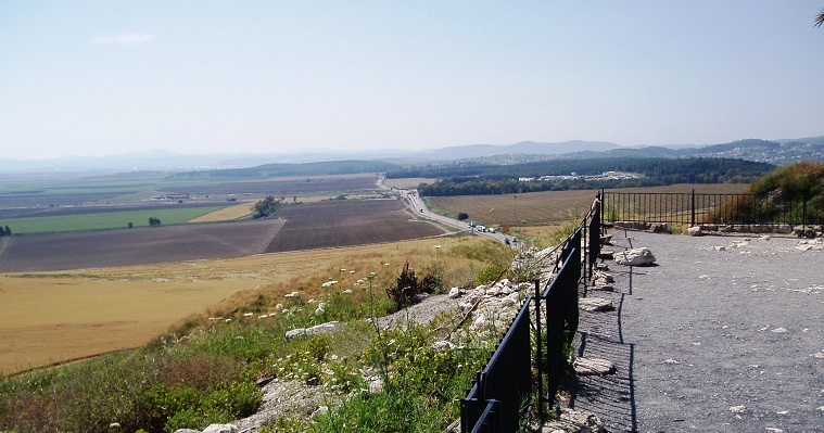
Two significant cities, one renowned for its temples, were established at the dawn of history on either side of the Wadi Ara pass along the Carmel Mountain range. The first, a city recently unearthed on the western slope of Carmel, is known as Tel Asur (near Ein Iron). On the eastern slope of Carmel lies the second, celebrated for its vast temple complex, Tel Megiddo. It’s important to recognize Mount Carmel as not only the most visually striking landmark along the nation’s coastlines but also a mountain sacred since ancient times. The Egyptians referred to it as “the Gazelle’s nose.” In this analogy, if we imagine the peak of Carmel as the nose, then Tel Asur and Tel Megiddo metaphorically serve as the two nostrils, with the entirety of Israel symbolizing the whole human.
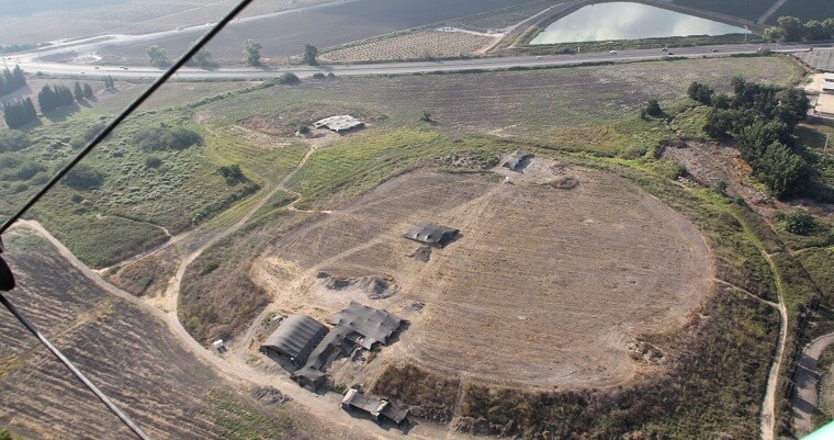
The discovery of the lost city of Tel Asur, unearthed by accident during the expansion of the Wadi Ara road, has dramatically reshaped our understanding of that era. It was unimaginable that, at the dawn of history, a city with more than 6,000 residents, covering an area of 650 dunams in the northern Sharon region, existed. This city was a well-organized settlement featuring a network of streets, drainage systems, temples, religious artifacts, seals, public buildings, and walls that were two meters thick. Remarkably, this city was absent from historical maps of early settlement in Israel, unmentioned in the period’s sources, and overlooked in archaeological literature. Yet, it had been there all along, its existence only brought to light by the excavation work for a road.
Tel Asur, a modest mound not far from Binyamina, belongs to a later historical period. Surprisingly, just a few tens of centimeters beneath the extensive agricultural fields that surround it, lies a vast city previously unknown. The onset of excavations unveiled numerous uniformly shaped houses, each approximately 10 meters in length and 3-4 meters wide, featuring a central row of columns. In some cases, the central space is partitioned by walls. A notable characteristic is that all house entrances align in the same direction, following a north-south or east-west axis, with a singular doorway leading inside. It’s believed that each house was home to a nuclear family. Surrounding these dwellings are courtyards with circular silos, and between the houses run orderly streets, intersections, and squares. However, unlike other cities like Beit Yerah, the street layout here is not linear; instead, the streets meander.
Surrounding the settlement, a robust wall two meters in width was uncovered. This wall, like the houses within the settlement, featured a foundation of stones with subsequent layers constructed from mud bricks. Amidst the residential structures, a large public edifice, believed to be a temple, was found. Within its courtyard, a substantial stone water basin was discovered alongside numerous sheep bones, likely remnants of sacrificial offerings. From this courtyard, one enters a spacious antechamber, home to another, albeit smaller, stone water basin. This leads into a vast room, spanning 100 square meters, presumed to be the main temple area. Noteworthy finds include a schematic face figurine, similar to those from Shaar Hagolan, and another depicting an animal. Additionally, seal rolls adorned with animal and human motifs, reminiscent of those from Sumer and Egypt, were unearthed, further enriching the archaeological tapestry of the site.
Dr. Itai Gilad, the lead archaeologist of Tel Asur, notes that the identity and beliefs of the people who inhabited the city at the outset of history remain largely unknown. However, it is evident that the city was governed in some form, with life meticulously organized from the orientation and architecture of houses to their placement within the broader settlement layout. The archaeological evidence suggests the presence of social stratification and complexity within the city, highlighted by specialized neighborhoods such as those of potters, and zones where houses were noticeably larger, indicating economic disparities. Gilad likens Tel Asur to the New York of its era—unmatched in size within the region and likely governed by a council of dignitaries. The city’s economy was based on agriculture, industry, and trade. Its strategic location on the king’s road, connecting Mesopotamia to Egypt, underscores its significance and suggests vibrant trade with regions as far-flung as Sumer and Egypt, as evidenced by the diverse origins of stone and pottery vessels found during excavations.
In Tel Asur, archaeologists unearthed over a hundred skeletons of young individuals, with none displaying evidence of violence. Similarly, the settlement itself bears no marks of destruction; it appears to have been simply abandoned around the end of the early Bronze age period (24th century BC) for reasons yet unknown. To date, only approximately 7% of the site’s area (about 40 dunams) has been excavated. The discoveries made thus far underscore how much remains unknown about the early history of the Land of Israel.
The Double Temple in Megiddo
Megiddo stands as one of the most ancient cities globally, prophesied as the site of the pivotal future battle of Armageddon, believed to herald the end of the world. This 60-dunam Tel has been settled for around 9,000 years, with one of Israel’s earliest cities founded here at the close of the 4th millennium BC, marking the dawn of recorded history. During this initial phase, the city boasted formidable defenses, palatial structures, thoroughfares, residential buildings, storage silos, and the most extensive temple complexes in the Levant.
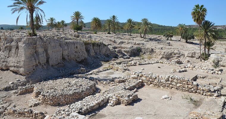
At the core of Tel Megiddo mound, archaeologists uncovered the largest ancient temple in the Levant, dating back 5,000 years. This temple, designed as a megalopolis—a square structure featuring a large entryway flanked by two walls extending outward to form a sort of balcony—measures 47 meters in length and 22 meters in width. This expansive area, covering over 1,000 square meters, could accommodate more than a thousand individuals. Within its confines, a pedestal was found, likely once supporting a deity’s statue, positioned to catch the first sunlight at dawn, reminiscent of Egyptian temple practices. Adjacent to this temple was another, slightly smaller temple, leading to the presence of a double temple complex. It’s theorized that these temples were dedicated to different deities, possibly one to a female and the other to a male deity, or one to the moon and the other to the sun.
East of the temple lay a courtyard paved with basalt stones, notable for the intriguing discovery of paintings on some of these cobblestones. Among these were geometric designs, such as grids or double lines, but several also depicted human figures: one painting shows a lion standing over a man, another features a man playing a harp beneath a moon, and a third portrays people walking under a star. Sarah Lee Gardner from the University of Arizona interpreted these images as astrological symbols. It’s also feasible to connect these three depictions—the lion (Sun), the moon, and the star (possibly representing the planet Venus)—with the representation of secondary Triad od Gods from Mesopotamian mythology – Shamash, Sin and Ishtar.
The magnitude and grandeur of Megiddo’s temple are unparalleled in Israel, suggesting that this sacred complex catered to the broader region rather than solely the city’s inhabitants. This could mean that a significantly larger city existed near Megiddo, extending well beyond the mound itself. Supporting this theory, a survey in the vicinity of the mound uncovered pottery remnants spread across over 500 dunams. It’s conceivable that a sprawling city, home to thousands, once thrived here, akin to a counterpart city of tel Asur on the opposite side of Carmel Mountain range. In this scenario, the mound of Megiddo would have served as the acropolis, or high city, of this larger urban center.
It’s fascinating to consider that Tel Asur and Megiddo are positioned a day’s walk apart, on opposite sides of Mount Carmel. Both cities lay on the ancient sea road, a crucial thoroughfare in antiquity linking Sumer with Egypt. Drawing an imaginary straight line connecting these two sites extends towards Mount Tabor and onward to Gamla, which was a pivotal city in the Golan during that era. Should Megiddo, at the dawn of history, have hosted a city of a scale comparable to Tel Asur across Carmel, one might anticipate similar architectural and urban planning features between them. This includes the likelihood of monumental temples in Tel Asur, akin to those in Megiddo, although such structures have yet to be discovered. It’s plausible that these temples remain hidden beneath the mound of Tel Asur, which, similar to Megiddo, might have served as an acropolis for the city.
Alternative theories propose that, at the onset of history, there was an understanding of energy lines linking various sites across the Earth. Ancient civilizations were knowledgeable about the Earth’s dimensions, the geography of its seas and continents, and even the distances to the sun and moon. They held the belief in energy lines crisscrossing the globe’s surface, viewing the planet as a living entity. Consequently, the principal sites in Egypt are interconnected by straight lines. For instance, the Great Pyramid aligns with the longitude of Aswan, creating an isosceles triangle with the delta’s extremities.
These theories suggest that the science of energy lines influenced the placement of sacred sites along specific orientations, resulting in clusters of such locations, sometimes separated by considerable distances. Beyond the line connecting Tel Asur, Megiddo, Mount Tabor, and Gamla, Megiddo’s orientation also relates to the southern peak of Carmel, known as the Horn of Carmel (Muhraka), visible over the nearby hills. Drawing a line from Megiddo to the Horn of Carmel and extending it further reaches the opposite end of Carmel – Rosh Carmel (Stella Maris). This implies that the precise positioning of Megiddo’s acropolis could be determined by aligning Rosh Carmel with the Horn of Carmel, extending the line southward to where it intersects with another line. This second line connects Mount Tabor, the Wadi Ara pass, and Tel Asur, suggesting a deliberate, ancient understanding of Earth’s energy lines in determining the locations of significant sites.
Megiddo’s strategic significance is largely attributed to its position at the gateway to one of the most crucial mountain passage along the ancient sea path, Wadi Ara. Its proximity to the fertile lands of the Jezreel Valley and the availability of year-round fresh springs made it an ideal location for establishing a city. My contention is that the precise site of the temple hill was selected based on sacred geography principles. The city or its temples could have been constructed a few kilometers away in any direction—evidenced today by the settlement of Megiddo, which is located near the hill rather than on it. This argument is supported by similar precedents found around the world, particularly in Egypt, both in historical times and prehistory, as I have discussed in my other publications.
Alternative sources suggest that the line connecting Megiddo with Carmel marks the commencement of the so-called “Apollo Michael Line,” a trajectory linking key sacred sites across Greece and Europe. This line is associated with prophetic significance in the classical era, attributed to Apollo, and with sightings of the Archangel Michael during the Middle Ages. The premise of these alternative theories is that these sites were chosen for their spiritual importance, situated atop ancient sacred locations dating back to the dawn of history, if not earlier, and their placement was deliberate. Megiddo’s position at the start of this line offers a unique interpretation of its prophesied role as the battleground for the apocalyptic clash at the end of days (Armageddon), as foretold in biblical prophecies, including those in Ezekiel and Zechariah.
Even without fully endorsing the theory of energy lines, it’s evident that Megiddo aligns with Mount Carmel on one side and Mount Tabor on the other, demonstrating specific orientations towards Tabor and Carmel’s southern peak, the Horn of Carmel. Similarly, the city of Beit Yerah aligns with Mount Hermon, Gal Yethro with Mount Karnei Hittin, among others. Since prehistoric times, Israel has recognized several sacred mountains, with Tabor and Carmel being among the most significant. Each possesses a unique and distinctive shape: Mount Tabor shape is round, a shape which ancient cultures associated with the element of water (or metal), while the Horn of Carmel peak is triangular, akin to a pyramid, symbolizing the element of fire for the ancients.
Nonetheless, it is posited that the grand temple was compromised by seismic activity. In the 27th century BC, a new complex of temples was constructed in Megiddo: a double temple, mirroring the previous one but smaller in size, and adjacent to it, and another temple with a Magron shape. Behind this was a walled courtyard featuring a circular worship platform with an 8-meter diameter. This platform became the focal point for worshipping the goddess “Baalat” following the Canaanites’ arrival in the region. Further details on this subject can be found in the chapter titled “Religious Development in Megiddo.”
To conclude this chapter, it’s noteworthy that the walls of Megiddo at the dawn of history were 8 meters thick, a characteristic shared with the fortifications of other contemporary cities, such as Beit Yerah and Tel Yarmut. This similarity suggests more than mere coincidence. Given that such robust walls were not necessary for city protection, as large-scale wars were not a feature of ancient times, it’s plausible to consider that these walls served a magical or ritualistic purpose rather than a purely defensive one. Furthermore, the specific thickness of the walls might have been influenced by sacred measurements (like the Egyptian cubit), possibly derived from the Earth’s dimensions or perhaps even referencing the human body.
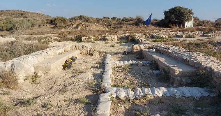
The city of death (Tel Yarmut)
Approximately three kilometers south of Beit Shemesh, archaeologists have recently unearthed an ancient city spanning 180 dunams. Atop its ruins, a significantly smaller city emerged, identified as the biblical Yarmut. It seems the name Yarmut has Canaanite origins, later evolving at the time of the city’s establishment from two words: “Yar” – a term for city, akin to “Yar” in “Yerushalem,” and “Mut”, which referred to the Canaanite deity of death, thus rendering Yarmut as “the city of the god of death.” However, death was not necessarily perceived negatively in ancient cultures, especially not within the Egyptian culture, which likely exerted influence over this city.
Founded around 5,000 years ago, Yarmut was home to about 3,000 inhabitants. The city featured a dense network of houses and streets laid out over an infrastructure of massive terraces meticulously constructed along the slopes of a hill, serving as a sort of acropolis. Yarmut was segmented into various districts, including areas designated for craftsmen, residential zones, a palace, and public spaces. The upper reaches of the city, yet to be excavated, likely housed a temple.
Aurélie Salavert, a Paris-based professor of archaeobotany, identifies the city of Yarmouth as an early hub for olive cultivation and olive oil production from the outset of recorded history. Echoing this view, Professor Philip Graham from England concurs and further notes that the dawn of history saw the introduction of new tool types in Israel, specifically designed for liquid storage. He interprets this as indicative of the initial use of wine and oil, signifying the advent of plantation agriculture.
The cultivation of vines and olives necessitates several years of growth before yielding produce, implying the establishment of property rights, a supportive legal framework, and the ability to enhance land value over time (for instance, through terrace farming). In essence, this requires a complex level of social organization. Moreover, the cultivation of these crops signifies long-distance trade, leading to wealth accumulation and social stratification. These factors collectively contributed to the founding of cities, paralleling the agricultural advancements and irrigation system refinements in Mesopotamia and Egypt that prompted a more intricate societal structure, culminating in the urban revolution. Interestingly, while cities were being established in the Land of Israel, there appears to have been an absence of writing, a fact that poses numerous questions. This is particularly striking given that, in Egypt, where the inhabitants of Yarmut engaged in trade, hieroglyphic writing was already in use, and in Mesopotamia, cuneiform writing had been developed.
With the advancement of field crop agriculture and the establishment of plantations, particularly olive and vine, there ensued a significant deforestation effort to clear large areas for cultivation, altering the landscape of the Land of Israel. Excavations near Tel Yarmut have uncovered evidence of land artificially enhanced through the importation of fill soil from other regions and extensive fertilization, strategies that evidently yielded benefits for the local populace. Prior to the dawn of history, wheat and barley cultivation often occurred amidst trees and in natural soil pockets, a practice reflected in Mesopotamian legends that was believed to enhance yields. However, the introduction of new crops and the evolution of farming techniques, such as plowing with oxen-drawn plows, necessitated a shift towards the development of large, tree-free plots of land to accommodate the changing agricultural practices and timelines.
The transformation of the landscape into one that was clear, open, and well-ordered marked a significant shift: the land now served the people, not the other way around. This human-shaped environment, interspersed with fields and roads, was punctuated by large cities that rose prominently from elevated positions, as if a web of human influence was weaving itself across the terrain. Society remained fundamentally agricultural, yet farming had evolved into an endeavor involving long-term investment, landownership, significant alterations to the terrain, and cultivation for trade.
This shift in agricultural practices necessitated a new form of societal organization. Kings and governments emerged to control production means and land, transforming farmers into subjects who owed taxes. The independent farmer of the past now depended on communal systems for land preparation, seed distribution, and market access. His produce was delivered to temple storehouses, from where it was redistributed by priests. In return, the farmer expressed gratitude for the benevolence of the king and deities, content in his role within this emerging social structure.
Tel Yarmouth was not an isolated settlement but part of a network of settlements spanning the entire Judean lowland. Close by lies Tel Tazfit, which was among the largest settlements in Israel, covering 400-500 dunams. In its vicinity are Tel Lachish and Tel Irani (near Kiryat Gat). These sites are visually interconnected from the hilltops, linking ancient cities in the region like Tel Beit Shemesh and Azeka, situated between the fertile valleys of Sorek and Ella. The prevailing theory suggests that this entire area functioned as a cohesive and distinct economic unit, primarily dependent on olive cultivation, with the produced oil likely destined for Egypt, where it was essential for lighting. It’s plausible that Yarmouth served as the nucleus of a city-state, possibly housing its king.
Around Yarmut, a wall constructed from gigantic stones and measuring 8 meters in thickness was found, mirroring the wall dimensions observed in Megiddo and Beit Yerah. However, Yarmut’s most remarkable discovery is a vast palace, unparalleled in Israel, likely erected in the 26th century BC—contemporaneous with the Great Pyramids of Giza. This palace is encircled by an unusually shaped jagged wall, reminiscent of the external walls of mastabas (monumental tomb temples from Egypt’s early dynasties) and the enclosure wall of Djoser’s step pyramid complex in Saqqara. Significantly, the construction of the palace’s inner wall utilized the Egyptian royal cubit, measuring 52.6 cm, as its unit of measurement.
Each protrusion on the jagged inner wall of the palace, among its numerous projections, measures precisely 3.5 Egyptian royal cubits in width and 4 cubits in length. The spacing between these projections is consistently 4 Egyptian royal cubits, while the width of the connecting walls is 3.5 cubits, adhering to remarkable precision. Furthermore, the interior architecture follows this metric system: for instance, the dimensions of the door thresholds are exactly 2.6 meters, equivalent to 5 Egyptian royal cubits.
The standard cubit measures approximately 46 cm, representing the distance from the elbow to the tip of the fingers on an outstretched hand. By adding the width of a horizontal palm to the standard cubit, the royal cubit is derived, amounting to 28 fingers or 7 palms, which equals 52.6 cm. The significance of this measurement lies in its relation to the Earth’s radius: 12 million royal cubits approximately equal the Earth’s polar radius.
Scholars studying the pyramids and temples of Egypt have suggested that the Egyptians employed standardized construction dimensions that reflect the proportions of the Earth and the human body, indicating a connection between the two. Measurement held a pivotal role in Egyptian culture, embodying a magical aspect: the belief that to invoke the energy of a given entity, one must align with its essence, adhering to the principle of “like attracts like.” This alignment was achieved through employing specific measurements in construction. The Egyptians recognized the presence of terrestrial energies and possessed the knowledge to “harness” these forces for their benefit. By incorporating dimensions related to the Earth in their architectural endeavors, they aligned the temples and pyramids with the Earth’s vibrational frequency, enabling these structures to channel its energy.
The measurement unit employed in constructing Egypt’s pyramids was the royal cubit, with each side of the Great Pyramid measuring precisely 440 cubits in length. Remarkably, within the Judean Lowlands, a palatial structure has been discovered, mirroring the architectural style of ancient Egyptian buildings (mastabas) and adhering to the same principles of utilizing and harnessing earth energies through specific measurements akin to those of the Egyptian royal cubit. Pierre De Miroschedji, the lead archaeologist at the site, notes that the palace at Yarmut bears resemblance to a sacred complex in Byblos, Lebanon, from the same era. Considering Byblos’s status as an Egyptian outpost, it underscores the likelihood of economic ties with Egypt during the dawn of history. Consequently, it’s plausible that Egyptian architects, possibly the same minds behind Egypt’s pyramids and temples, were commissioned to design the palace, reflecting the deep-seated connections between these ancient civilizations.
Archaeological findings at Tel Yarmut reveal a structure that served as a palace, yet its design also indicates a dual purpose as a temple, reflecting common multifunctional use in ancient times. The palace’s encompassing wall encircles a vast area of 6,000 square meters. Within this perimeter lies a large southern courtyard, a smaller northern one, and numerous rooms and halls centrally located. The palace’s northeastern entrance leads directly into a columned hall, unique within the region, featuring nine standing columns that echo the style found in Egyptian temples. This hall supported a second level and provided access to a compact inner courtyard. Beyond this space lies a throne hall, complete with benches, leading to storage areas presumed to hold the palace or temple’s valuables. Among the discovered items were jars scattered across the floor, containing agricultural products, including olive oil. A distinct room laid with a pebble floor, devoid of any column bases and resembling an additional inner courtyard, was also uncovered, suggesting the pebble flooring held a specific significance.
Yarmut was deserted for reasons that remain unclear at the close of the early historical period (24th century BC), with much of the city remaining uninhabited ever since. De Miroshdeji points out that the palace bears resemblance to a contemporaneous structure unearthed in Megiddo, known intriguingly as “3177,” which was likely also a palace. It’s conceivable that similar palatial buildings existed in other principal cities from the dawn of history in Israel, though they have yet to be discovered. He further hypothesizes that a substantial temple complex might lie south of the palace, awaiting excavation. Given the remarkable discovery of Tel Asur, the scope for discovery seems boundless. Who knows? Perhaps future excavations will reveal that beneath the mound of Yarmut lies a hidden pyramid.
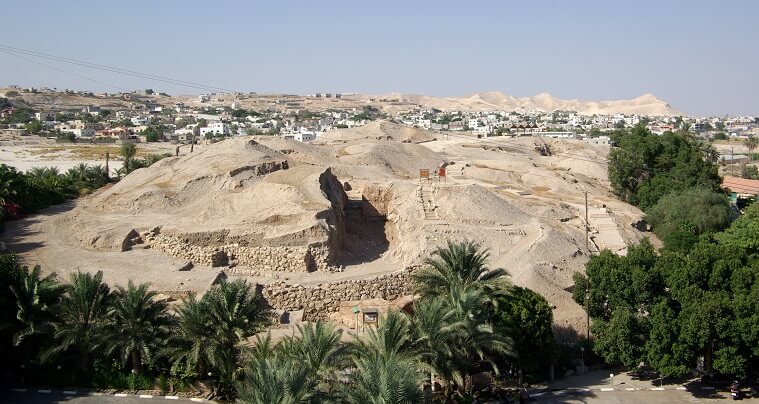
Jericho
Jericho holds the distinction of being the world’s first permanent settlement, founded around 11,500 years ago. Kathleen Kenyon, who led the excavation of the site, argued that it represented the world’s inaugural city. However, Jericho was not a city in the conventional sense but rather a sizable village that underwent intermittent periods of habitation and transformation over 6,000 years. By the onset of recorded history, around 3000 BC, Jericho underwent reconstruction, emerging this time as a bona fide city. This evolution introduced large and formidable walls, public edifices, a splendid palace, temples, and a systematic urban layout comprising streets, neighborhoods, and residences.
The ancient wall of Jericho spans a perimeter of 1 km, with its foundation comprising large stones measuring 5-6 meters in width, atop which bricks were stacked to reach a height of 9 meters. Constructing such a massive wall would have necessitated the labor of hundreds of individuals over the course of a year, likely undertaken as a means to cultivate an ethos of dominance and to manifest presence, rather than solely for defensive objectives. It’s plausible that the workforce was assembled not just from the city’s inhabitants but also from the agricultural communities in the surrounding regions.
Jericho, a verdant desert oasis, is known for its plentiful springs. The local authorities managed these water sources, likely establishing irrigation systems that boosted productivity in the nearby agricultural zones—a scenario that might parallel developments in Beit Yarah. As a result, the city’s governance played a crucial role in sustaining a population far greater than its immediate inhabitants. While Jericho itself was home to an estimated 2,000 people, it’s probable that several hundred to thousands more in the surrounding areas benefitted from the city’s amenities, particularly its water distribution services.
The newly established streets of Jericho were laid out in straight, interconnected patterns, mirroring the urban designs seen in Tel Yerah and Arad. Within the city, industries flourished, notably in ivory and pottery, alongside the processing of metals, precious stones, and wood. Storage facilities for agricultural goods such as beans and wheat were also uncovered. In 2700 BC, Jericho experienced a significant earthquake that led to the collapse of its walls—and this time, Joshua was not to blame. The city underwent a cycle of reconstruction and destruction, being rebuilt and then razed again in 2500 BC, followed by another round of rebuilding and final destruction in 2350 BC. Unlike many other cities from the dawn of history, Jericho’s destruction was marked by violence, likely the result of a conquest.
The inhabitants of Jericho at the dawn of recorded history differed significantly from those who had lived there for thousands of years prior. It’s believed these new settlers were immigrants, possibly arriving from the north, introducing new burial customs to the area. While previous practices involved interring the deceased beneath house floors or in megalithic structures like dolmens, the newcomers adopted the method of carving out rock caves for tombs. In Jericho, such tombs were found in underground chambers accessible via shafts, bearing resemblance to ancient Egyptian tombs. However, aside from this aspect, there were no other burial features akin to those found in Egypt, such as paintings or statues.
Sodom and Gomorrah
On the Jordanian side of the Dead Sea, particularly in the region where the sea forms a “tongue,” lies an ancient settlement from the dawn of history known as Bab e-Dahra. This city, enclosed by walls spanning 100 dunams, featured a tower, a circular platform akin to that of Megiddo, gates, and houses reminiscent of the biblical depiction of Sodom. It was home to about 1,000 inhabitants and was abandoned at the end of the era without any evidence of violent destruction. However, in close proximity, four other cities (Numeira, Tzafi, Feifa, and Hanzir) met violent ends, with signs of fire damage discovered within them. Numeira, the most extensively researched among them and slightly smaller than Bab e-Dahra, was violently destroyed in the 24th century BC, around the same time as the destruction of Jericho. The presence of these five cities near the Dead Sea and the evidence of their catastrophic ends have prompted their association with the biblical cities of the Sodom pentapolis, leading to the hypothesis that Bab e-Dahra and Numeira might represent the historical Sodom and Gomorrah.
Adjacent to Bab e-Dahra is a vast necropolis, comprising tens of thousands of rock-carved graves accessible via shafts from above, reminiscent of burial practices in Jericho and akin to those in Egypt. This site served as a regional cemetery, where individuals from Numeira and the surrounding cities within the area, as well as possibly from farther reaches of the country, were laid to rest. A typical grave features a shaft leading down to one or more chambers, where bones were commonly placed in the center, skulls arranged along the sides, and bowls and urns of a distinctive material and shape were found, along with various votive items like bracelets, olive heads, figurines, and more. These chambers, measuring 1.5-2.5 meters in diameter, were usually sealed with a heap of stones. In subsequent periods, above-ground structures, either round or rectangular (some partially submerged), were constructed. These buildings, slightly larger in size, housed a similar assortment of skeletal remains and burial artifacts, continuing the area’s long-standing funerary traditions.
Researchers estimate that over the course of a millennium, the cemetery near Bab e-Dahra saw the interment of more than half a million individuals. This suggests that bodies or skeletons were transported from across the country for burial at this sacred site. The sheer scale of the cemetery, spanning nearly a square kilometer, bears resemblance to the necropolis of Saqqara in Egypt, indicating a perception of the entire country as a unified entity, with each location fulfilling a specific purpose. The ancients might have held the belief that in the world’s lowest place, also known as the Sea of Death, there lay the potential for life after death. Therefore, the significance of the Bab e-Dahra cemetery could have been viewed as a gateway to the afterlife, offering a connection to the world beyond, in a specific place.
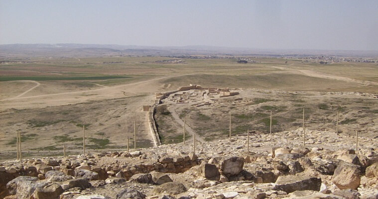
Tel Arad
Tel Arad stands as a significant archaeological site, representing one of the largest and most crucial cities from the dawn of recorded history. This city was founded in a deliberate, planned manner around 2950 BC, only to be abandoned mysteriously 300 years later, with no apparent reason for its sudden desertion. Since then, the ancient parts of the city remained uninhabited, leaving behind some of the most well-preserved and insightful ruins from that era. Encircled by a cyclopean stone wall, Tel Arad exhibited advanced urban planning features, including a sophisticated water collection system. Excavations have revealed temples, houses, streets, a well, and evidence of industrial activity. Prior to its establishment in the historical period, there was already an ancient settlement on the site. The city, once established, spanned over 100 dunams, marking a significant phase in the region’s development.
Arad functioned within a regional network, supported by surrounding villages and a nomadic population that utilized its services. Archaeologist Kempinski, in his study on Tel Arad and the onset of urbanization in Israel, argues that surplus production and technological innovations resulted in wealth accumulation and a population increase, crucial factors in the city’s establishment. He highlights a specific population ratio between a settlement and its hinterlands as a defining characteristic of its urban nature. This dynamic interaction between Arad and its surrounding area was pivotal in its development into an urban center.
Archaeological assessments suggest that in the ancient cities of the Land of Israel, each individual occupied an area of roughly 6-10 square meters, indicating that a hectare (10 dunams) could comfortably accommodate 200-300 people. This implies that the ancient city of Arad housed between 2,500 and 3,000 residents. The city was organized into neighborhoods, with some featuring larger residences than others. Among these homes, imported Egyptian pottery was discovered, including fragments bearing the name of Narmer, the founder of the ancient Egyptian kingdom, hinting at the presence of wealth and social stratification. Many of these artifacts were painted jugs from Abydos, used for storing wine, pomegranate juice, oil, seeds, and other goods, suggesting a distinction in dietary habits based on social status—the affluent likely consumed wheat with flax seeds and legumes, while the less fortunate subsisted on barley. The discovery of a grave containing a 1.85-meter-tall man aged around 60 years old indicates that the conditions in the area were conducive to a relatively good quality of life.
In Arad, a distinctive architectural style known as the “Arad house” emerged, a model of which has been reconstructed on the site. This type of dwelling became prevalent in the southern region of the Land of Israel for a millennium. Beyond residential structures, Arad also boasted a temple complex featuring two pairs of temples. In each pair, one temple was larger and the other smaller, both surrounded by spacious courtyards equipped with in-ground basins, altars, and structures designated for ceremonial use. These temple pairs were aligned along a north-south axis. Within the larger temple pair, the northern room housed a grand basin, while the southern room contained a Stele (Matzeva) made of dolomite stone, intricately carved in honor of what is believed to have been a deity.
The use of stone Steles (Matzevot) to symbolize divinity is an ancient practice, traceable to cultic sites in the Negev from as early as the 9th millennium BC. This form of worship transitioned from desert locales to the early cities of the Land of Israel, finding its place in all significant temples unearthed in the region since the onset of recorded history. The architectural motif of paired temples likely reflects the concept of divine counterparts, embodying both male and female aspects. The substantial pair of temples in Arad is reminiscent of the grand double temple found in Megiddo from the same era, and the overall layout bears similarities to sacred complexes in Sumerian cities, where basins were also a common feature.
Alongside the temple complex, Arad also featured a sprawling palace encompassing numerous rooms and courtyards. Within this palace, a ritual stone stele was discovered, adorned with the engraved figures of two humans positioned in prayer—one reclining and the other standing above, with an oat-like symbol replacing the head. Archaeologists interpret this imagery as a depiction of the Mesopotamian deity Tammuz (Dumuzi), who is mythologized as being deceased for half the year and resurrected for the other half. This representation of Tammuz symbolizes the cyclical growth patterns of wheat, a crop of significant importance to the ancient inhabitants of the region.
It seems that during the early historical period, up until the mid-3rd millennium BC, the climate in the Arad Valley was more favorable than it is today, supporting a diverse range of agricultural activities, including plantation farming. Excavations throughout the city have uncovered substantial quantities of wheat, barley, lentils, peas, flax, chickpeas, and olives, alongside numerous sickle blades. A shift in climate occurred subsequently, which may have contributed to the city’s abandonment around 2650 BC. However, it’s conceivable that other factors also played a role in this decision.
The copper, flint, and pottery artifacts unearthed in the Arad region bear a resemblance to those found in South Sinai, with laboratory analyses confirming a link between the two areas. This evidence suggests that the inhabitants of Arad engaged in commerce with the people of South Sinai, particularly in the trade of copper goods. Arad likely served as a key hub for distributing copper vessels to both Israel and Egypt, justifying the establishment of a large city at this location. The copper might have originated from the Punon mines in the nearby Arava, with the finished products being manufactured either within the city itself or in other Negev settlements. The city’s eventual abandonment may have been tied to a disruption in trade with Egypt during a certain period.
Among the most striking discoveries in Arad are the cyclopean walls, constructed from enormous stones that encircle the entire city. These walls extend over 1,200 meters in length, stand 2.4 meters wide, and feature 11 semi-circular towers and two gates. Prof. Philip Graham has questioned the necessity for such formidable defenses in a place like Arad, pondering over what precisely needed such protection. Although Arad experienced a devastating fire and destruction around 2800 BCE, the subsequent rebuilding of the settlement suggests that this calamity wasn’t the result of an external conquest. Furthermore, the rationale behind choosing to establish a settlement with a specific urban layout in a semi-desert area raises curiosity. This is especially intriguing when considering the alternative of settling in a loosely organized community or irregular settlements, which was the norm in other parts of the Negev at the time and remains so today.
Graham posits that the walls around Arad symbolize ideology and power, mirroring the purpose behind the walls constructed around the Egyptian city of Memphis (Biblical Mof) during the same era. The urban design of Arad is meticulously planned. The city’s layout is concentric, with a depressed central area where the water reservoir is situated, encircled by a ring of public buildings. The street system is dual-layered: one network runs peripherally, maintaining elevation, while another is radial, with all roads leading towards the central depression. The sacred complex and the palace are strategically positioned along the main thoroughfare that descends from the western gate, integrating these key structures into the city’s core design and function.
The identity of the architect responsible for the design of Arad’s city structure, as well as the identities of those who constructed it, remains somewhat enigmatic. What is evident, however, is that Arad, along with other significant sites in the Land of Israel that emerged seemingly out of nowhere at the onset of recorded history, was developed according to a comprehensive master plan. This approach mirrors the concept behind designs of Sumerian cities, which suggests construction was carried out in accordance with a divine blueprint provided by the gods. This notion underscores the possibility that early urban development was not only a matter of practicality and defense but also deeply intertwined with ideological and religious beliefs.
Sacred geography
Tracking the settlement and cultural focal points across different eras in the Land of Israel reveals a dynamic shift over time. At the dawn of recorded history, the pivotal axis was along the Kinneret-Carmel line. On one end stood Beit Yerah, possibly the largest city in Israel at the time, while on the other end were significant urban centers like Megiddo and Tel Asur. Approximately a thousand years later, with the emergence of the Canaanites, the epicenter migrated northward to Hazor in the Hula Valley and concurrently to the western locales of Kabri and Acre. In the prehistoric period, the heart of activity was positioned further south in the Dead Sea region, notably Jericho, alongside Ein Ghazal in Jordan and the Jerusalem area. Thus, through various chronological phases, the settlement nucleus in the Land of Israel transitioned from south to north, consistently manifesting as a dual center—one part in the Jordan Valley and the other in the western part of the land.
Alternative theories propose viewing the country (as a geographical entity) as an organism that functions as a fractal of the whole, mirroring the structure of the human body or the universe in a reflection of mutual patterns. This perspective was how the ancients reportedly viewed Egypt, and it is believed that a similar perception applied to the Land of Israel. Hence, the shift of the cultural and settlement center from the south to the north within the Land of Israel might be analyzed in terms of its correlation with energy centers found in the human body. This approach suggests exploring the positioning of these historical sites and their spatial relationship to the land envisioned as a human figure, seeking to understand the underlying connections and significances.
This discussion offers a prime opportunity to delve into the interplay between architecture and the sacred geography of antiquity. Luwvitz demonstrated that Egyptian temples encapsulate the human form in two distinct ways: a line within the temple’s courtyards and chambers symbolizes the posterior aspects of the human body, extending from the back of the brain down to the heel via the spine, aptly termed the “line of stability.” In parallel, another line within the temple mirrors the anterior aspects, drawing a connection from the forehead and frontal brain, through the chest, down to the toes, and is referred to as the “line of movement.” This architectural and symbolic integration underscores the profound connection between physical structures and metaphysical concepts in ancient Egyptian spirituality.
The two axes, stability, and movement, are not only distinct in their orientation but also manifest through differing dimensions within the temple architecture. Interestingly, this duality is mirrored in Egyptian paintings, where figures simultaneously depict both a profile and frontal view. In a single portrayal, one might observe a person’s chest and pelvis in frontal perspective while their head and legs appear in profile. This ability to hold seemingly contradictory, yet potentially complementary perspectives simultaneously was a hallmark of Egyptian artistic expression, reflecting a profound understanding of metaphysical concepts within their culture.
Hence, when seeking parallels between the positioning of ancient cities and temples in the Land of Israel and the human body, we must consider multiple points of reference. It’s reasonable to posit the existence of concurrent networks of location and orientation. For instance, one trajectory of development aligns with the Jordan Valley, akin to Israel’s backbone, analogous to the line of stability in temples. Meanwhile, another trajectory unfolds along the coastal plain, akin to the line of movement in temples. This dual perspective allows for a richer understanding of the sacred geography intertwined with ancient architecture.
In contemplating the Land of Israel as a Human figure, its head to the north and feet to the south, a fascinating analogy emerges. The Jordan Valley corresponds to the back of this figurative form, where numerous ancient cities flourished. Meanwhile, prominent sites such as Tel Asur, Megiddo, and Carmel mark the foreground, extending northward to Acre, Kabri, and Nahariya during the Canaanite era. Notably, Jerusalem occupies a region akin to the heart, while Ashkelon, Gaza, and the Nahal Habesor area are situated in positions evocative of the Pelvis. This analogy offers a compelling perspective, shedding light on the intertwined relationship between the landscape and human anatomy in ancient sacred geography.
Indeed, further exploration of this topic promises intriguing insights. It suggests a master plan guiding the placement of sites and temples across the land, orchestrated by the body of priests who, akin to their Egyptian counterparts, may have traversed the region with measuring rods in hand. These priests likely offered counsel to local rulers, influencing decisions regarding the location and orientation of sacred structures. Such a coordinated effort underscores the spiritual significance attributed to the alignment of these sites within the landscape, reflecting a profound understanding of sacred geography and its connection to the human experience.
crisis
In the 24th century BC, many ancient cities in the Land of Israel were either abandoned or destroyed, a phenomenon that might have been influenced by climatic changes. Around 2300 BC, a significant climatic crisis occurred, evidenced by the lowering of the Dead Sea levels, reduction in forest vegetation around Lake Kinneret (Sea of Galilee), sand intrusion into the coastal plain, a drop in the Nile’s water level, and a decrease in the silt depositing in its delta, among other effects. However, major cities near Carmel and the Sea of Galilee were unlikely to be directly impacted by such a crisis. Therefore, the reasons for their abandonment or destruction might be tied to the invasions of Semitic tribes into the Levant or to geopolitical shifts in the fertile crescent, though this is not certain. There are no clear signs of violent destruction in many of these cities, suggesting they were often simply left deserted.
Despite various scholarly theories, the reasons behind the abandonment of large, developed cities, the cessation of agriculture, and the shift towards nomadic lifestyles in ancient Israel remain unclear. This is particularly puzzling given that, during the same period, Egypt continued to thrive under the Sixth Dynasty for another century.
Susan Richard, an archaeologist with excavation experience in Jordan, notes that while agricultural settlement did continue in some areas, it was predominantly within the context of temporary nomadic encampments, with only a minor portion occurring in permanent, non-urban settlements. The key change observed was the decline of urban centers, leading to a reduction in societal and production complexity. Richard suggests this shift may be tied to the collapse of trade networks, influenced by the emergence of the Egyptian trade center in Byblos, Lebanon, which diverted the flow of imported goods from the cities of Israel to Egypt. Additionally, Egyptian military campaigns in Israel might have played a role. Archaeological evidence indicates a cessation of maritime trade with Egypt and the abandonment of settlements in North Sinai, with no signs of violent invasions but rather evidence of societal disintegration and gradual change. Richard’s excavation of Khirbet Iskander in the highlands of Moab reveals that this city remained active even after the cultural decline in the 24th century BC, suggesting a complex picture of continuity and change in the region.
Every crisis indeed brings opportunities, and the vacated landscapes of the Land of Israel were repopulated by peoples migrating from the Amorite mountain region in Syria, surrounding deserts, and possibly Mesopotamia among other locations. Initially arriving as nomads, these groups eventually laid the foundations for an advanced, complex, and magnificent culture. They revitalized and reconstructed cities and settlements, a story that will be told in the following chapter.